

South State Street Plan Will Test Westerville’s Approach To Redevelopment

The city sees aging commercial properties, fragmented ownership, and changing retail patterns along one of its most visible corridors. A dispute over when residents should become involved in redevelopment decisions also shapes the planning process.
Westerville will ask residents on June 23 to consider the future of South State Street, a corridor the city has sought to improve for more than two decades.
The South State Street Focus Area Plan is one of two connected projects introduced through Plan Westerville. A citywide assessment will examine broader trends and the city’s progress since adopting its 2016 Community Plan, while the South State Street study will use that work to develop a more detailed strategy for a specific part of the city.
The first Plan Westerville Community Check-In is scheduled from 6 to 8 p.m. The city has promoted the meeting through its website and social media channels, directing residents to information on the planning process and participation opportunities.
The meeting is not about a single development proposal. No immediate zoning changes, property acquisitions, or construction projects are being presented for approval.
The discussion, however, follows the city’s handling of 64 E. Walnut St., where residents objected to learning about a proposed sale and redevelopment agreement after negotiations with a developer had advanced.
City Council unanimously rejected the agreement on June 2. The city has said no new legislation or development proposal for the property will return to council until residents receive more information and have opportunities to discuss the site’s future.
The Walnut Street dispute raised the same question now facing South State Street: whether the public will help establish redevelopment goals before the city begins working on individual projects with property owners and developers.
A long-standing redevelopment priority
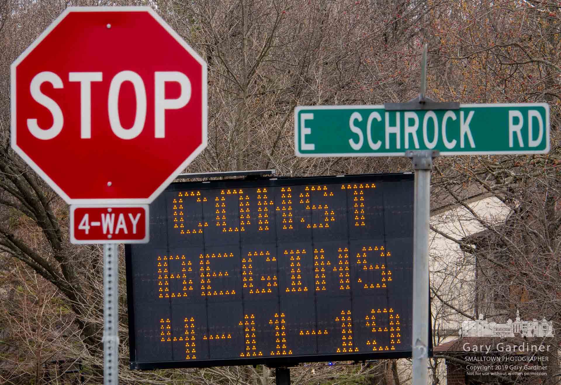
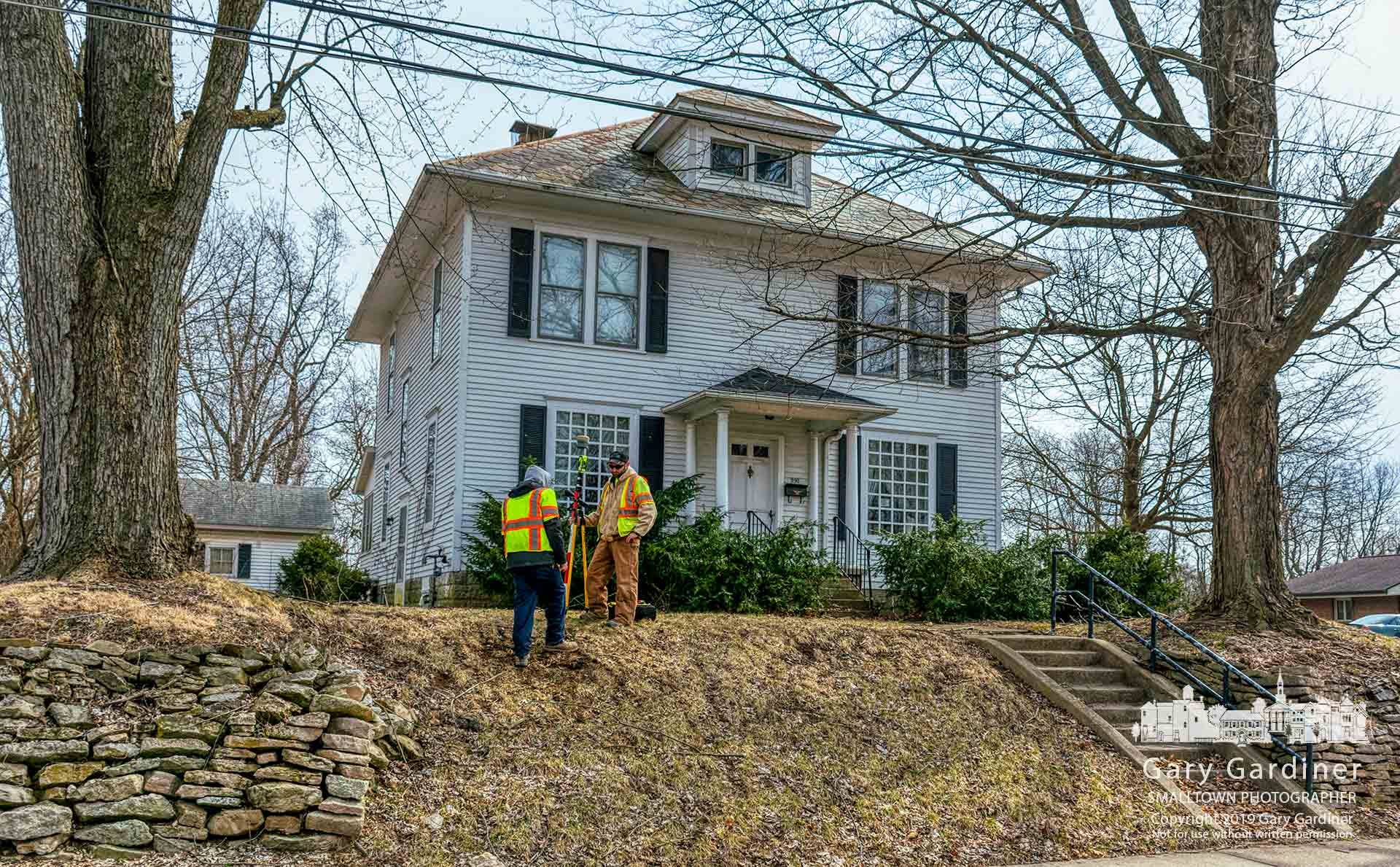
South State Street has been a city planning concern since at least 2002, when Westerville adopted a corridor study that identified traffic congestion, changing land uses, aging shopping centers, unattractive conditions, and a lack of identity. The city described that study as a first step toward facilitating redevelopment.
Westerville later created a special overlay district intended to produce a more unified development pattern. Its standards address building scale and placement, parking, loading areas, landscaping, lighting, signs, and other site features. The district also seeks better pedestrian connections to nearby neighborhoods and stronger links between the corridor and surrounding areas.
Streetscape guidelines adopted in 2008 focused on the space between the roadway and buildings. They addressed sidewalks, street trees, driveways, access management, overhead utility lines, traffic signals, landscaping, and street furnishings.
Those efforts established rules for individual projects but did not resolve all of the corridor’s broader challenges.
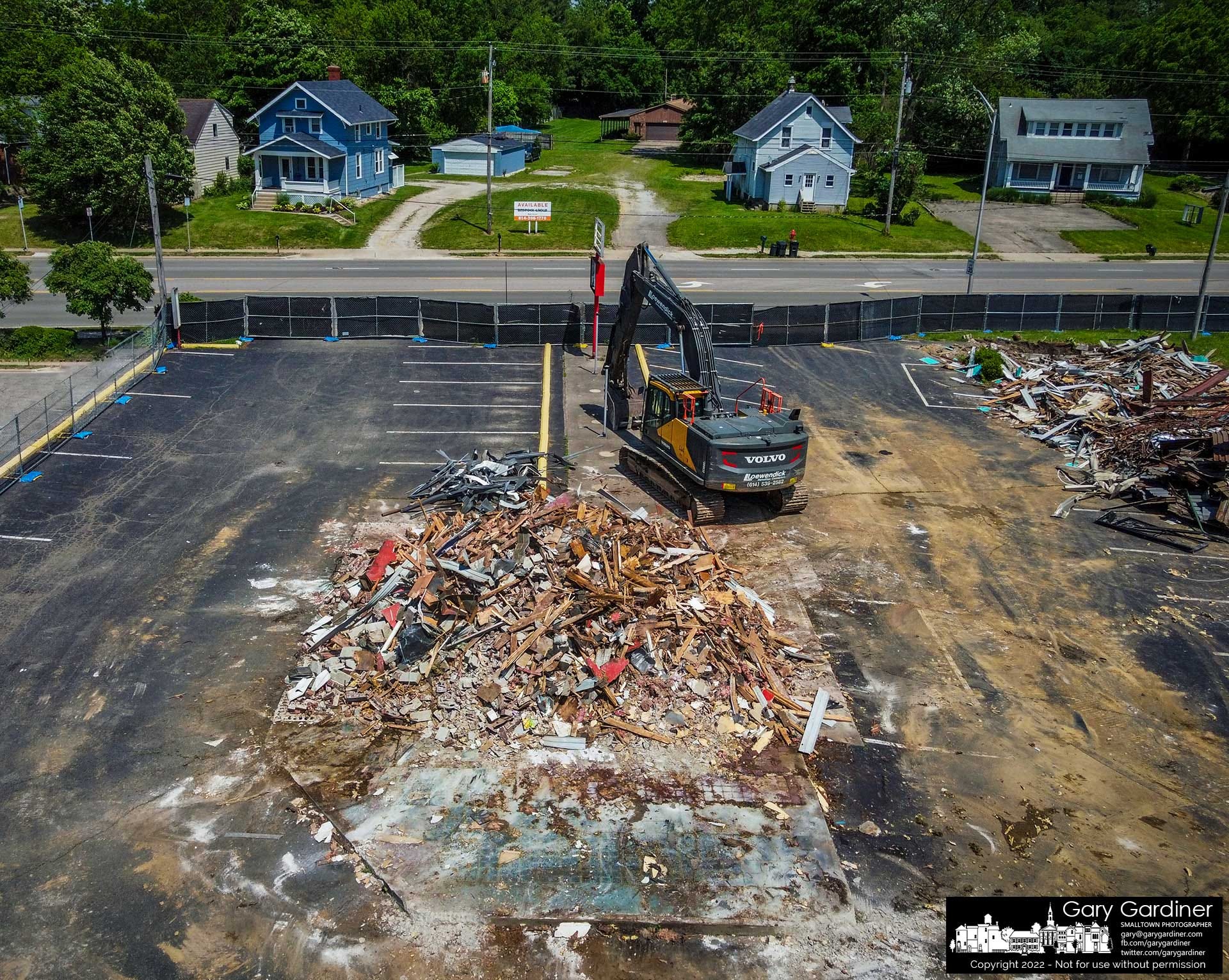
The city now describes South State Street as one of Westerville’s most visible and complex areas. It connects neighborhoods, businesses, and other destinations, but it also includes aging commercial properties, changing retail patterns, underused parcels, fragmented ownership, and significant infrastructure needs.
The city expects the corridor to change, and the purpose of the plan is to establish how Westerville should guide that change.
What redevelopment could mean
Redevelopment would not necessarily mean demolishing the entire corridor or replacing all existing businesses.
Change could occur gradually as properties are sold, renovated, or adapted to new uses. An older building could be reused. A large parking lot could accommodate another building. Adjacent properties could share driveways or internal roads. A shopping center could add housing, offices, restaurants, or public space while retaining some commercial uses.
The focus-area plan will examine property conditions, ownership, zoning, and infrastructure readiness. It will also evaluate market demand, identify redevelopment and placemaking options, recommend transportation and public space improvements, and outline possible funding sources, partnerships, and implementation phases.
The combination of planning, engineering, and market analysis is important because a concept may appear workable in a plan but remain unlikely to occur if rents and property values cannot support acquisition, demolition, construction, and infrastructure costs.
The city is working with planning firm MKSK, engineering consultant Burgess & Niple, and Vista Site Selection, which is providing market and economic analysis.
Residential development could enter the discussion if retail redevelopment alone cannot generate sufficient value to support new construction. Apartments, townhouses, offices, medical uses, or mixed-use buildings are among the types of development that could be evaluated during the process.
No scenario has been adopted. The city says any recommended zoning or policy changes would require separate public review and approval. It also says existing owners and businesses will not face immediate changes unless the city takes further action, keeping the process limited to planning for now.
Limited land changes the calculation
The South State Street discussion is part of a broader challenge facing Westerville, which covers about 12.6 square miles and has little undeveloped land remaining.
The city covers about 12.6 square miles and has little undeveloped land remaining. Much of its future growth, therefore, will have to come through reinvestment in properties that are already occupied or developed.
Commercial corridors are logical places to study because some contain older buildings, large parking areas, and infrastructure capable of supporting additional activity. They also provide access to major roads and may accommodate development without extending it into the interior of established residential neighborhoods.
Redevelopment along an existing corridor, however, is rarely simple.
Properties may have different owners with different plans. A project requiring several parcels can be delayed or prevented if one owner declines to participate. Existing leases may remain in effect for years. Utility systems may need replacement. New construction may also require expensive changes to traffic signals, turn lanes, sidewalks, drainage systems, or access points.
The interests of the city, property owners, businesses, customers, and nearby residents also may not align.
The city may classify a one-story building surrounded by parking as underused because the property could support more jobs, housing, or tax revenue. The same property may offer a useful business location, convenient access for customers, or comparatively affordable space for a small business.
The plan will need to define what the city means by ‘underused’ and explain how that classification will affect future recommendations.

Traffic is both an advantage and a problem
South State Street’s access and visibility have long supported commercial activity. The corridor connects with regional roads and carries residents, workers, and visitors through the city.
That same traffic that makes the location valuable also creates difficulties.
Numerous driveways can produce conflicts as vehicles enter, exit, and cross several lanes. Large intersections can be difficult for people walking or riding bicycles. Properties developed separately may lack internal connections, forcing drivers to return to State Street to reach a neighboring business.
Earlier corridor planning called for improved access management and stronger connections among properties. The current plan will again focus on mobility, public space, and connectivity.
Westerville also has a separate mobility-planning effort examining traffic counts, intersections, street design, truck routes, transit, trails, and sidewalks. The South State Street study will need to align with that broader transportation work.
The transportation analysis will need to address whether additional development can occur without worsening congestion, particularly near heavily traveled intersections.
Vehicle counts alone will not answer that question. A mixed-use project may generate more activity on a property while allowing some trips to be made on foot or between uses on the same site. Better internal connections could reduce the number of short trips on State Street. Greater development intensity, however, could increase pressure if transportation improvements do not occur simultaneously.
Planning for existing businesses
The city presents the focus-area plan as a way to support the long-term success of existing property owners and businesses, not simply to attract replacement development. It says owners and businesses will receive information about redevelopment opportunities, public improvements, and future investment.
Redevelopment can increase property values and bring new customers, but it can also raise rents and taxes. Locally owned businesses may be less able than national companies to absorb those costs. Construction can interfere with access, and a new development pattern may favor tenants different from those the corridor currently supports.
The plan, therefore, will need to address more than the appearance and use of new buildings. It will also need to consider the effects of redevelopment on businesses already operating along the corridor, including the availability of affordable commercial space and the potential for disruption or displacement, which is the central concern here.
Those issues are significant because South State Street is not vacant land. It is an active corridor with existing businesses, employees, and customers.
Public involvement after Walnut Street
Westerville says residents, business owners, and other stakeholders will be able to participate through open houses, pop-up events, surveys, interactive maps, and written comments.
The city’s website and social media accounts provide several ways to announce events and reach people who may not attend formal planning meetings.
The Walnut Street dispute, however, showed that providing notice and offering opportunities to comment are not the same as demonstrating how public input affects a decision.
The South State Street process is expected to identify potential redevelopment areas and recommend the kinds of changes the city should encourage. Those recommendations could shape later discussions with property owners and developers even before a formal application is submitted.
The city will need to explain how it records public input, weighs competing views, and connects comments to its recommendations. It will also need to establish how property owners and businesses will participate before their properties are included in redevelopment concepts.
Another challenge will be distinguishing planning illustrations from development proposals. Drawings used to evaluate building heights, density, or combinations of land uses would not constitute approvals. Once published, however, they could be interpreted as representing the city’s preferred outcome.
Clear explanations about the purpose and status of those concepts will be important throughout the process.
A model for future focus areas
The city intends the South State Street plan to serve as a template for similar studies elsewhere in Westerville. That gives the corridor significance beyond its boundaries.
The process could establish how the city identifies redevelopment areas, studies market conditions, works with property owners, gathers public input, recommends zoning changes, and decides whether public money or infrastructure should support private investment.
In a community with little vacant land, those methods may be used repeatedly.
South State Street is therefore both a planning project and a test of Westerville’s redevelopment process. The city must show that it can prepare for change rather than wait to react to individual applications. It must also demonstrate that proactive planning gives residents and businesses an early role, rather than establishing development expectations before they enter the discussion.
The corridor’s aging properties, heavy traffic and fragmented ownership make change difficult. Westerville’s limited supply of undeveloped land makes avoiding the issue equally difficult.
The measure of the South State Street plan may not be whether everyone agrees with its final recommendations. It may be that residents, businesses, and property owners can see how their participation influenced those recommendations before individual projects begin moving toward approval.

Because this post is public, you’re encouraged to share it on social media.
The Westerville News is a reader-supported publication by Gary Gardiner, a lifelong journalist who believes hyper-local reporting is the future of news. This publication focuses exclusively on Westerville—its local news, influence on Central Ohio, and how surrounding areas shape the community.
Reader funding, including subscribers, protects editorial independence, so coverage is guided by journalists rather than owners or corporate profit goals. It also reduces pressure to chase clicks, letting the newsroom focus on stories worth readers’ time. And it helps keep the site accessible to everyone, including people who can’t pay or live in places where a free press is under threat.
Explore more hyper-local reporting by subscribing to The Hilliard Beacon, Civic Capacity, Marysville Matters, The Ohio Roundtable, Shelby News Reporter, This Week in Toledo, and Into the Morning by Krista Steele.
